INTERACTIVE MUNICIPAL FLOOD PREDICTION MAPS AND ALERTS
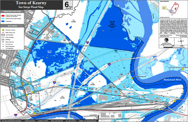
Through the Meadowlands Environmental Research Institute (MERI), the NJSEA offers a water alert system and flood prediction maps to first responders and the public. The email and text-based alerts for Meadowlands District towns are sent when water levels reach 5.5 feet above sea level and continue to be relayed as the levels rise. The interactive, web-based flood prediction maps include what parts of Meadowlands District municipalities may flood at sea surge levels ranging from 4 to 8 feet above sea level.